This time, let’s look at GPX Viewer and GPX Viewer PRO from the perspective of our users. Most of the users rely on the app for such outdoor activities as hiking, cycling, and exploring new trails. In this article, you will discover how GPX Viewer PRO can help you in a completely different activity: photography. Meet Miguel Antuna, a talented photographer from Mexico, who shares with us how GPX Viewer PRO assists him and his colleagues in capturing breathtaking moments during sports events.
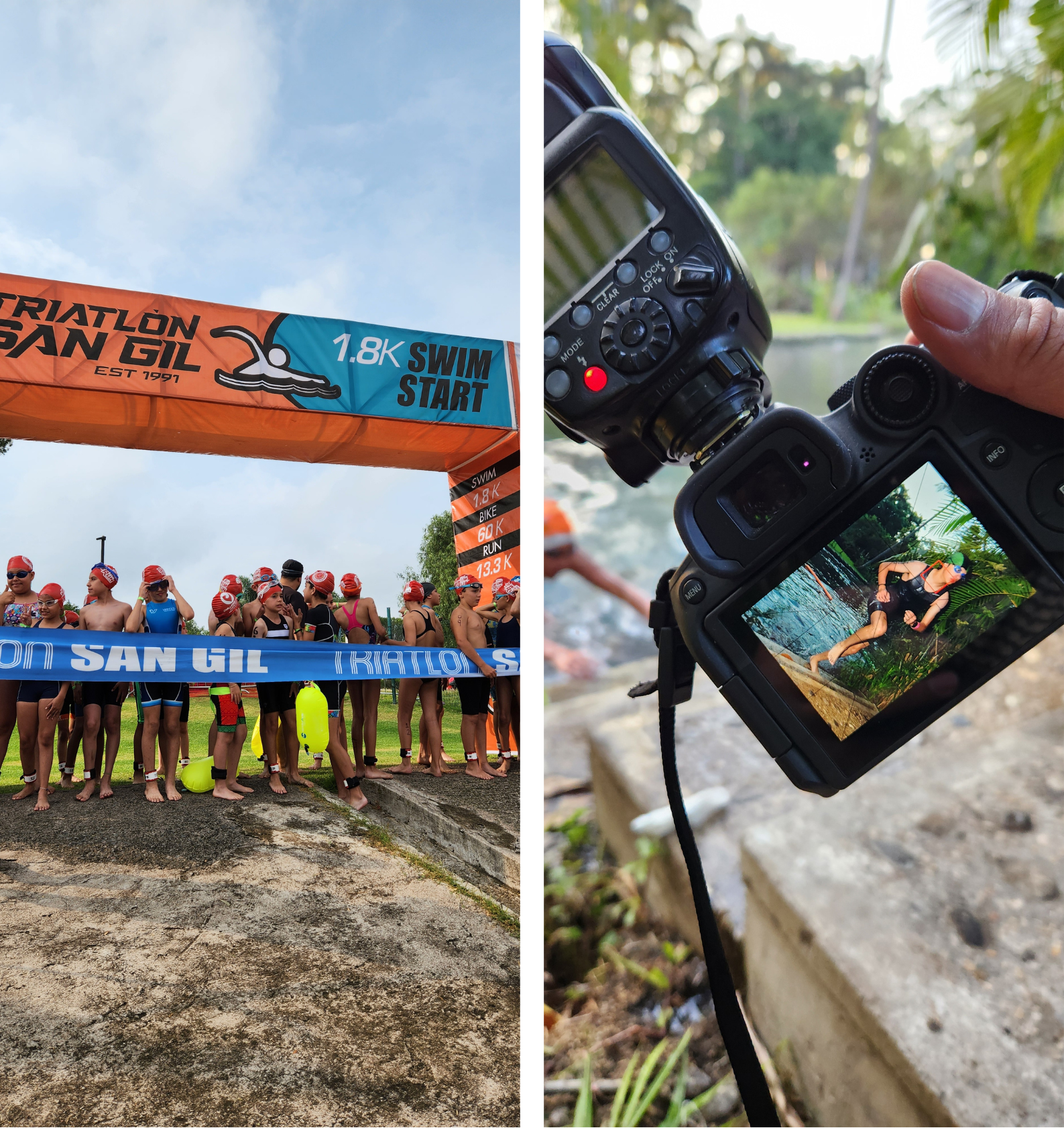
I am Miguel Antuna, a photographer with over 12 years of experience in photography, and since 2018, I have specialized in sports photography. I work at PhotoPlanet, a company dedicated to covering sports events such as marathons, triathlons, cross country, road cycling, and mountain biking, among others. We have worked on events like the Ultra Marathon Coahuila, which has routes of 30K, 50K, 100K, and up to 163K; Oso Negro Trail with distances of 30K, 50K, and 100K; and Desafío en las Nubes, with routes from 20K to 60K. Another of our notable events is the Triathlon San Gil, among others.
Our job involves positioning photographers along the route. For example, photographer 1 covers kilometer 20 and photographer 2 covers kilometer 60 of a 100K route. Photographers are on the route from 2 to 12 hours, taking pictures of all the runners passing by their location. They cannot move from their position and remain there, which makes the job extreme, as we are exposed to anything, such as the weather, bears, and being alone in the middle of the forest and nowhere. GPX Viewer has greatly helped us reach our locations safely, thanks to the different map styles, whether it is a novice photographer just joining PhotoPlanet or an experienced photographer with years with us. One of the first instructions we give to new photographers is to download GPX Viewer and, if possible, purchase the Pro version.
As a photographer at PhotoPlanet, I keep the app and maps updated to avoid any conflicts, since there is no mobile signal on the mountain routes. Therefore, I have all the maps downloaded, including GPX Viewer and Google Maps. Most organizers already have the route mapped in GPX format, but unfortunately, some do not, which can be a problem for us. Fortunately, nothing regrettable has ever happened. On the other hand, runners also use GPX Viewer. At PhotoPlanet, we really like it and use it frequently.