Planning an outdoor adventure is always exciting. But to ensure your trip is smooth and enjoyable, it is essential to have the right tools. With GPX Viewer PRO on your iPhone or iPad, you’ll be fully prepared for any trip — whether you’re planning a small hike or a multi-day journey. Follow this step-by-step guide to get ready for your next adventure using GPX Viewer PRO on iOS.
Choose your destination
First step is to decide where your next adventure will take you. Here you have two options for adding a route to the app:
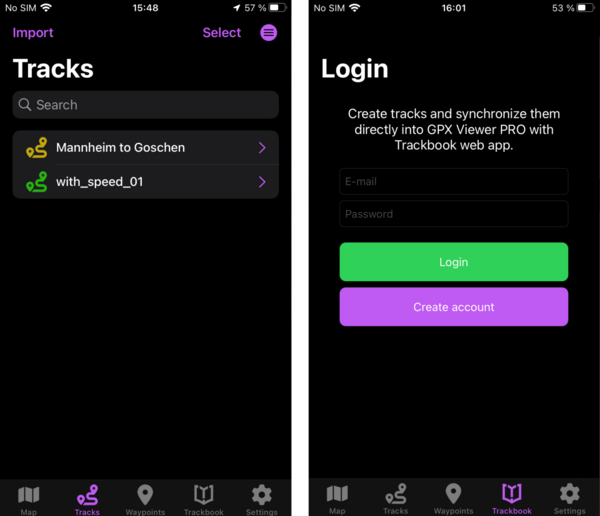
- Find a track on the internet and import it to GPX Viewer PRO. Just tap the Tracks menu button, here you will see the list of your tracks, tap the Import button and select your file.
- Create your own track using our web tool Trackbook. Trackbook planning moods help you tailor your track specifically for your trip, like choosing roads more suitable for biking with the bike mode. Once you’ve finished planning, simply tap the Trackbook menu button in GPX Viewer PRO and login to Trackbook, your Trackbook tracks will sync with GPX Viewer PRO.

Decide which map style to use
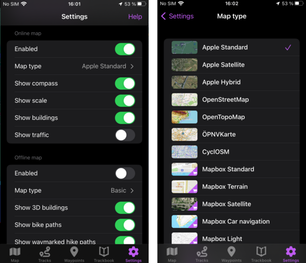
Are you planning to explore an area without reliable internet connection? This is not a problem with GPX Viewer PRO, just make sure to download offline maps of the needed regions and you will stay on your route even in the most remote destinations. To switch between online and offline maps tap the Settings menu button and scroll down. Here you can also select the map style that will suit your outdoor activity the best. For example, Apple satellite online map is ideal when you want to see the actual landscape and terrain details.

Learn more about your track
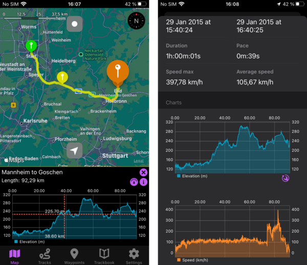
Now it’s time to dive deeper into the details of your upcoming outdoor adventure. Tap the start or end point of your track to view the elevation graph below map. If you tap on the graph and scroll, you will see elevation data for specific spot and this spot will also be shown on the map. This helps you understand how challenging your route might be and also helps you with planning — such as planning extra rest stops for steep climbs or moving faster on flat sections, leaving more time for a picnic. Want to check more track details? Tap on the “i” button on the right of the graph to open the full statistics. Here you to see such data like climb and descent length, elevation difference, and more. Another way to open track statistics is to tap Tracks in the menu and select your track.

Ready to go
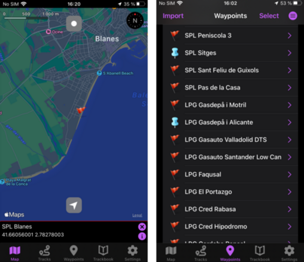
With your track loaded and maps prepared, you’re all set. As you embark on your adventure, you may come across a new interesting spot — a nice picnic area, a cozy cafe or a breathtaking view. Don’t forget to mark your favorite spots as Waypoints with a long tap, so you can easily find them again later. Want to add more information to your waypoint? Easy! Tap waypoint icon on the map, on the bottom of the screen appears information about the waypoint, tap on “i” button to see the full waypoint information (or tap the Waypoints button in the menu and select your waypoint from the list). Set waypoint name,color, icon, and add a description, for example opening hours of the cafe you liked.

GPX Viewer PRO on iOS will make it easier for you to get ready for your next outdoor adventure, wherever you plan to go. From planning your route to exploring detailed maps and track statistics, you’re well-equipped for any challenge the outdoors throws your way. So, whether it’s a small local hike or an epic cycling trip, GPX Viewer PRO has you covered.


