
We’re always working to make GPX Viewer PRO even better — and the latest iOS version 1.27 brings some great new features and improvements to help you organize your outdoor adventures even more easily. Let’s dive into what’s new and how these changes can enhance your experience on the trail.
Enhanced sync with Trackbook (with active Online services subscription)
If you use our web app Trackbook to plan your hikes or rides, you’ll love this: with active Online services subscription, you now get enhanced synchronization between GPX Viewer PRO and Trackbook. This means, now you can not only access your Trackbook tracks in GPX Viewer PRO, but you can also edit metadata (like names and descriptions) of your Trackbook tracks and waypoints or delete your Trackbook waypoints or entire tracks if they’re no longer relevant.
Let’s say you created a hiking route on Trackbook with several waypoints and then logged in to Trackbook with GPX Viewer PRO to have your new track with you on your hike. During the hike, you learn something new about the location or decide that some planned stops which you marked as waypoints aren’t necessary. With this update, you can easily adjust or clean up your route on the go — right from GPX Viewer PRO. Make needed changes faster and save more time to explore your route!
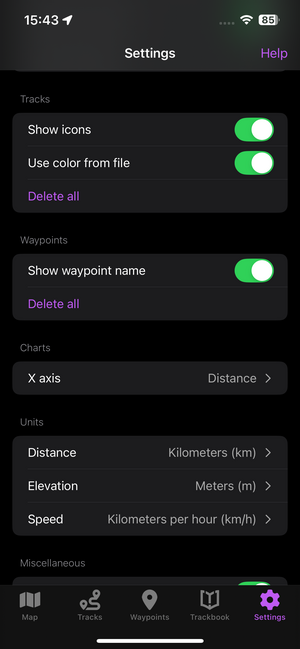
Show or hide waypoint names
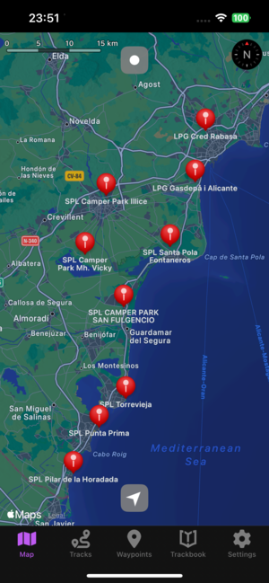
Did it ever happen to you that too many waypoint names were cluttering the map? You can now choose in the settings if you want to show waypoint names or to hide them. This option is perfect for example if you’re traveling in a new area with multiple saved tracks and waypoints. Hide the names when you want a cleaner map view, and show them again when needed — it’s all up to you. This gives you more control over how your map looks and helps you stay focused during your trip.
Explore Mapy.com premium online map styles
We’ve also expanded our selection of premium online map styles — now including Mapy.com maps. These maps are known for their clean and beautiful design, with details that are especially helpful for outdoor activities.
Choose from different map styles:
- Basic map – clean and simple for everyday use in cities and towns.
- Outdoor map – highlights hiking trails, bike paths, terrain, and tourist points.
- Winter map – shows ski slopes, cross-country trails, and winter terrain features.
These premium maps are available with an active Online services subscription and bring a new look to your outdoor planning.
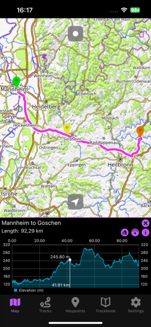
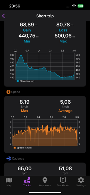
Better map chart experience
Exploring your track’s elevation profile just got easier. In previous versions, if you stopped scrolling the elevation chart, the indicator would disappear — making it harder to pick up where you left off. Now, with the new update the GPS position marker stays visible after you lift your finger. This means you can pause, look at the chart in general, and easily continue exploring. This small but helpful improvement makes analyzing your route’s elevation much smoother. We also improved the map chart marker showing x and y values to make reading your track details easier.
Enhanced track and waypoint detail screens
We’ve also improved the track and waypoint detail screens to make them more informative and easier to read and give you a clearer overview of your data.
Whether you’re planning a new hike, reviewing a recent ride, or just organizing your saved tracks — GPX Viewer PRO on iOS version 1.27 brings thoughtful improvements to help you enjoy the outdoors even more.


I installed the latest GPX Viewer PRO version on my iPhone and imported some tracks and waypoints. I want to organize the tracks and waypoints using folders, but I can’t find a way to do it. Is this option disabled?
Hello, thank you for your comment. Currently it is not possible to organize tracks nor waypoints into folders. However it is planned to be added in the future.
Why do https://gpxviewer.com/ have link to play store and not to iOS app store?
Hello, thank you for your comment. It does have on GPX Viewer PRO iOS website: https://vecturagames.com/gpxviewerproios . This https://gpxviewer.com website it dedicated to Android app as it does have different UI.